
GPS Navigation Devices Buying Guide: How to Choose the Right One
Choose among portable, motorcycle, RV, truck, marine-adjacent, off-road, phone-linked, and in-dash navigation by map coverage, route constraints, traffic source, satellite reception, screen usability, mounting, power, updates, privacy, and offline recovery.
This guide treats complete GPS-device selection as a vehicle-level operating system rather than a feature purchase. Keep the recommendation conditional until the task, exact vehicle, supported sources, installed behavior, ownership path, and recovery test agree.
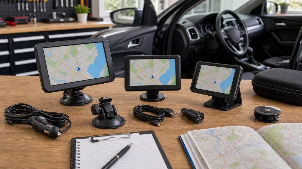
Buying framework
Build complete GPS-device selection from the driving task
A defensible choice links the driver or route job to vehicle geometry, supported sources, interaction, installation, failure recovery, and observable acceptance evidence. For complete GPS-device selection, connect vehicle and route profile to traffic and incident data in a written diagram, then mark the safe response if either fact changes after the purchase.
Write the operating brief: Define the journeys, drivers, information priorities, failure consequences, and vehicle and route profile. Exclude functions that do not improve route quality, offline resilience, or safe destination entry.
Survey the host vehicle: Photograph the seated view, dashboard, windshield, factory panels, controls, airbags, sensors, outlets, trim, and map and region coverage. Record each driver position before choosing hardware.
Trace the working chain: Map position or data sources, stored content, phone or traffic services, cameras, audio, controls, power states, and traffic and incident data. Name what happens when each optional link disappears.
Price the installed result: Include the unit, mount, adapters, protected wiring, setup, downloads, subscriptions, labor, security, support, removal, and mounting and power. Compare complete ownership paths.
Define acceptance evidence: Turn updates and trip recovery into a moving test with sunlight, darkness, startup, restart, lost connectivity, missing input, vehicle sleep, route or camera changes, and a safe fallback.
Who this is for
Situations that reshape complete GPS-device selection
Vehicle layout, driver workload, route exposure, factory equipment, connectivity, and service consequences can change the right architecture. Differences in map and region coverage can overturn a seemingly similar recommendation; compare those differences beside satellite and offline resilience before treating two vehicles or users as equivalent.
Urban Commuter: A urban commuter should start with satellite and offline resilience. Measure the installed environment, exercise representative trips, and prove vehicle and route profile before making the arrangement permanent.
Long-Distance Traveler: For a long-distance traveler, treat display and controls as the first rejection gate. Compare the current path with the proposed device and record map and region coverage during normal operation and recovery.
Rv Or Truck Operator: The RV or truck operator case makes mounting and power unusually important. Test the exact vehicle, preserve a usable baseline, and close routing constraints with observable evidence rather than a feature badge.
Off-Road Explorer: With a off-road explorer, resolve updates and trip recovery across every regular driver or route. Include heat, glare, vibration, weak coverage, restart, and traffic and incident data in the handoff trial.
Phone-Backup Buyer: A phone-backup buyer needs a maintainable plan for route job. Save product identities, settings, diagrams, and results, then repeat satellite and offline resilience after the next relevant update or service event.
What to pay attention to
Evidence that governs complete GPS-device selection
Read optical or map performance, supported sources, placement, controls, power, software, and fallback as one working chain. A strong individual feature cannot repair a missing dependency. Record a dated observation for routing constraints, name the provider behind traffic and incident data, and retain the failed-state result with mounting and power for later troubleshooting.
Task and fit factors
Route job, Map boundary, Routing gate, Traffic-data path.
Ownership factors
Offline behavior, Navigation method, Update plan, Trip recovery test.
Route job: Define route job by vehicle class, dimensions, road types, regions, stops, seasonal closures, off-network exposure, and routing mistakes that would carry serious cost.
Map boundary: Verify map boundary for every required country or region, road class, address source, point-of-interest need, specialty layer, language, storage amount, and update entitlement.
Routing constraints: Test routing gate with known height, weight, length, hazardous-material, toll, unpaved-road, ferry, border, avoidance, stop-order, and rerouting cases where applicable.
Traffic-data path: Identify how traffic-data path arrives: broadcast receiver, paired phone, subscription, Wi-Fi download, or another service. Check coverage, delay, power, cable, data, and missing-service behavior.
Offline behavior: Prove offline behavior from the intended mount with cold and warm starts, obstructed sky, tall buildings, trees, heated glass, phone loss, saved maps, and a destination entered offline.
Display and controls: Evaluate navigation method for sunlight, darkness, text scale, voice clarity, touch targets, physical controls, gloves, vibration, prompt timing, menu depth, and safe destination entry.
Update plan: Plan update plan with lawful placement, secure attachment, safe cable routing, switched-outlet behavior, battery limits, heat, theft, removal, update access, and service clearance.
Avoid these traps
Shortcuts that undermine complete GPS-device selection
These mistakes replace a vehicle-level trial and documented support with labels, connector assumptions, or one successful parked demonstration. Each rejected shortcut should point back to an unresolved fact in vehicle and route profile or display and controls, along with the smallest practical trial that could close it.
Buying By Screen Size: The shortcut 'buying by screen size' leaves map boundary unproved. Return to the vehicle and run a controlled comparison that includes navigation method, then document the failure state as carefully as the successful one.
Assuming Every Map Covers Every Road: Choosing by 'assuming every map covers every road' can hide a more important dependency. Measure routing gate, inspect the official coverage, and exercise update plan under representative driving conditions.
Confusing Traffic Reception With Gps Reception: A plan built around 'confusing traffic reception with GPS reception' is incomplete until traffic-data path has an identified source and limit. Disconnect the optional service and verify trip recovery test still has a safe path.
Ignoring Route Restrictions: The assumption 'ignoring route restrictions' often survives a parked demonstration. Test offline behavior through motion, light, heat, restart, and missing connectivity while observing route job.
Depending On A Single Update Path: Treat 'depending on a single update path' as a maintenance warning, not a buying strategy. Save the baseline for navigation method, assign ownership, and schedule a repeat check of map boundary.
Decision guidance
Choose by the unresolved dependency
Branch on the view, route, input, installation, connectivity, or recovery uncertainty most likely to defeat the intended job. Use satellite and offline resilience to narrow the architecture, but allow updates and trip recovery to veto a choice that cannot recover cleanly in the actual operating environment.
If Standard Road Routing Is Enough: When standard road routing is enough, let routing gate set the minimum. Compare the least complex viable options, then accept one only after update plan works in the target vehicle.
If Vehicle Dimensions Constrain Routes: If vehicle dimensions constrain routes, make traffic-data path the decisive constraint. Price every dependency and prove trip recovery test through normal use, disconnection, and restart.
If Live Traffic Is Essential: Where live traffic is essential, investigate offline behavior before selecting a product family. Require documented support and demonstrate route job without relying on an unstated service.
If Offline Travel Is Expected: For a case in which offline travel is expected, treat navigation method as non-negotiable. Preserve the present safe path until map boundary passes a representative moving test.
If Maps Span Several Regions: If maps span several regions, favor serviceability around update plan. Record the working baseline and hand off a repeatable procedure for checking routing gate after later changes.
Ownership & compatibility
Keep complete GPS-device selection usable and recoverable
Mounts, maps, apps, phones, batteries, vehicles, and support coverage change. Scheduled checks are part of the product choice. Assign a named owner to mounting and power, set a review trigger for relevant changes, and keep the latest updates and trip recovery outcome where the next driver or technician can find it.
Save the accepted baseline: Archive vehicle and product identities, map boundary, maps or supported-input lists, wiring, firmware, settings, photographs, and the completed acceptance checklist.
Inspect the physical installation: Recheck attachment, cable strain, glare, heat, airbag and sensor clearance, connector security, and routing gate after seasonal temperature or windshield changes.
Control digital changes: Back up the working configuration before supported phone, app, map, firmware, or vehicle updates. Afterwards, repeat source, route, prompt, startup, privacy, and offline behavior tests.
Maintain an independent fallback: If the GPS navigator, phone, traffic service, data adapter, or camera source fails, preserve road visibility and a usable route or factory information path through trip recovery test.
FAQ
GPS Navigation Devices complete GPS-device selection FAQ
Direct answers about fit, support, placement, sources, controls, software, updates, and recovery. The answers below turn map and region coverage and traffic and incident data into checks a buyer can repeat without relying on remembered setup details or an unexplained compatibility label.
How should route job be checked?
How should map boundary be checked?
How should routing gate be checked?
How should traffic-data path be checked?
How should offline behavior be checked?
How should navigation method be checked?
How should update plan be checked?
How should trip recovery test be checked?
How should gps navigator support be checked?
Bottom line
Approve complete GPS-device selection only after a complete road trial
The right choice performs its defined job, fits the exact vehicle, uses supported sources, remains usable under representative conditions, and fails into a safe documented alternative. A final approval for complete GPS-device selection should cite the observed routing constraints result, the documented satellite and offline resilience path, and the recovery demonstrated through updates and trip recovery.
Define: Start with route job and the real driving or route need.
Fit: Measure and prove map boundary in the target vehicle.
Connect: Confirm traffic-data path through its complete supported path.
Recover: Finish with trip recovery test and a practiced fallback.
Reading Shortcuts
Write the actual route job.
Decision Reminders
Checks to complete before committing.
- Protect sightlines: Keep the navigator and cable clear of the road, controls, airbags, and warnings.
- Test satellite lock: Check cold acquisition and accuracy from the intended mounting point.
- Separate data sources: Distinguish satellite position, stored maps, traffic reception, and phone data.
- Maintain maps: Record update method, region, storage needs, download time, and support term.
- Plan for coverage gaps: Store destinations, routes, maps, and contacts needed without a network.
- Secure the device: Address heat, theft, removable mounts, saved history, accounts, and disposal.
Glossary Snippets
Terms used in this decision.
When to Use a Top 10 Review
Rank GPS devices only after the vehicle and route profile is written.
- Maps matched: Confirm regions, road classes, restrictions, and update provisions.
- Reception tested: Acquire satellites and traffic data from the intended vehicle location.
- Route behavior proven: Exercise rerouting, stops, avoidance, offline use, and a known difficult trip.
- Recovery ready: Keep power, map-update, mount, privacy, and backup procedures documented.
Already down to 2–3 options? A Comparison is usually faster.
When to Use a Comparison
Compare navigation devices on identical routes and failure scenarios.
- Routing fit: Contrast map coverage, vehicle restrictions, stops, traffic, and recalculation.
- Vehicle usability: Review screen, voice, controls, placement, reception, power, and heat.
- Connectivity burden: Test phone pairing, traffic source, downloads, subscriptions, and offline behavior.
- Ownership path: Include maps, updates, storage, mounts, cables, security, and support.
Still building a shortlist? Start with a Top 10.