
GNSS Receiver
Hardware that estimates position and time from compatible navigation satellite signals.
- Clear sky improves reception
- Position is not a road map
- Receivers do not supply live traffic
A dedicated GPS unit makes sense when navigation must remain available without depending on a driver's primary phone, cellular plan, notifications, or app state. The device combines a GNSS receiver, stored map database, route engine, vehicle power connection, speaker, and purpose-designed controls in one persistent cockpit tool.
A smartphone is often the easier choice for current search, live services, messaging integration, and one-device convenience. The dedicated unit earns its space when offline continuity, specialized truck or RV routing, a fixed mount, replaceable navigation hardware, or separation from the phone matters more. Its maps still age, traffic may need an external receiver or phone link, and vehicle-specific restrictions require verification.
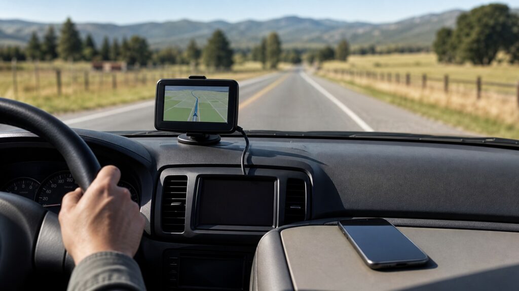
The decision turns on which components must work for position, maps, route calculation, traffic, power, input, and recovery during the actual trip.
Tip: Before a remote or commercial trip, run the planned route offline, confirm map coverage and restrictions, and carry an independent way to identify location if the primary screen fails.
These terms prevent the GPS satellite signal from being confused with maps, traffic, or route intelligence.
Hardware that estimates position and time from compatible navigation satellite signals.
A road and place database stored inside the navigation device for local use.
Software selection of a path using map topology, preferences, and known restrictions.
A set of dimensions, weights, or use rules applied by compatible specialized navigators.
Hardware or a connected service that supplies incident and congestion information beyond the stored map.
The ability of one navigation path to remain useful when another device, network, account, or power source fails.
Tip: Treat location, map coverage, routing rules, and traffic as separate inputs; each can be correct while another is outdated or unavailable.
The receiver computes position from satellite signals while the stored database supplies roads and destinations. The routing engine joins them locally, allowing basic guidance outside cellular coverage when the relevant maps are installed and the device has power.
Offline navigation works because position, maps, and calculation reside locally, not because the device knows every recent road change.
Purpose-built units may accept height, length, weight, hazardous-material, road-surface, or adventure-route preferences unavailable in ordinary car apps. Those inputs can screen mapped restrictions, but missing data and temporary closures still demand sign compliance and judgment.
A specialized profile reduces some routing mismatch; it does not certify legal or physical clearance.
Stored guidance is local, yet live congestion, weather, fuel prices, phone calls, or richer destination search may require a radio receiver, paired phone, subscription, or Wi-Fi update. Garmin documents products whose traffic capability depends on the correct receiver cable.
A dedicated navigator can be offline-capable without every feature being offline.
A stable cradle, sunlight-readable display, loud guidance, glove-friendly controls, and permanent power can reduce handling during repeated work. Poor placement can obstruct sight lines, cables can interfere with controls, and suction mounts can release under heat.
Purpose-built controls help only when installation keeps the device visible, secure, and non-distracting.
Choose dedicated hardware when navigation failure carries meaningful cost and the device supplies a needed map, profile, display, or redundancy advantage. Choose the phone when live search, traffic, account continuity, and minimal cockpit hardware matter more.
The better navigator is the system that still meets the trip's requirements under its likely failure conditions.
Dedicated hardware can keep core guidance local while creating separate map, power, mounting, and update responsibilities.
Remote travel, fleet work, specialized vehicle routing, repeated long trips, and phone-independent redundancy can justify a dedicated navigator.
A persistent mount and predictable interface can reduce setup friction for drivers who use navigation as equipment rather than an occasional app.
Smartphones commonly offer fresher search, richer live data, easier sharing, and fewer objects or cables in the cabin.
A dedicated unit is not automatically more accurate, current, or independent if its maps, power, traffic feed, or settings are neglected.
These myths confuse receiving satellites with possessing current, suitable navigation intelligence.
Satellite visibility can be impaired by tunnels, dense structures, terrain, antenna placement, or device faults. Position also cannot replace missing map coverage, power, correct vehicle settings, or current information about closures.
Road geometry, addresses, businesses, speeds, restrictions, and points of interest change. Garmin advises keeping maps and software current; an offline database remains useful only within the age and coverage of its stored information.
The profile filters known mapped attributes using the dimensions entered, but databases can omit restrictions and temporary conditions. Posted signs, permits, official notices, and the driver's assessment still control the trip.
Many phone apps support downloaded maps and the phone still contains a GNSS receiver. The exact offline search, rerouting, traffic, account, and map coverage behavior depends on the app and preparation.
Tip: Evaluate the entire route system, including maps, restrictions, traffic, power, mounting, updates, and the driver's recovery plan.
These answers cover position accuracy, traffic, map updates, phone independence, and using both systems together.
Not categorically. Antenna design, satellite view, supported constellations, software, mounting, environment, and sensor assistance all matter. The dedicated advantage is often operational packaging and independence rather than a universal accuracy margin.
Some can through a compatible broadcast receiver, sometimes built into the vehicle power cable; others need a paired phone or data service. Verify the exact model, region, cable, coverage, and subscription terms.
Check before consequential trips and follow the maker's update process. Install while external power and reliable internet are available, then verify the map version and planned route because the device may be unusable during installation.
It matters when the phone must remain available for calls, photography, dispatch, or emergencies; when battery or thermal load is a concern; or when navigation continuity has financial or safety consequences.
Redundancy helps only if failures are not shared. Use separate stored maps, verified chargers, known mounts, and a practiced fallback; two screens depending on one outlet or phone connection may not be independent.
Use a dedicated GPS unit when local maps, specialized routing, a fixed interface, or independence from the primary phone solves a real operational risk that outweighs another device's maintenance burden.
Verify coverage, update maps, understand how traffic arrives, enter vehicle data accurately, and test the fallback before the route becomes consequential.
These explainers clarify what remains on the phone, what the vehicle supplies, and how connected monitoring can create shared dependencies.
Compare the phone-to-vehicle connection that carries many smartphone navigation sessions.
See how vehicle power, displays, data links, antennas, and accessory installation support navigation equipment.
Examine the sensors, communications, accounts, and data handling behind ongoing vehicle status services.
Choose a retailer
Prices checked regularly. We may earn a commission at no cost to you.